Resurrection Pass
Quick Facts:
Drive time from Anchorage: 2 hoursMileage: ~39 milesElevation gain: ~3,800 feetActivity: BackpackingRecommended time: 3-5 days
This is likely the best-maintained long trail in Alaska and has lots of signage. With the elevation gain being so gradual and the trail very well-maintained, we were able to hike a lot faster than anticipated and completed the trail in 3 days, 2 nights. I recommend doing the trail from north to south for a more gradual climb, plus this saves the prettier views for the end. We ran our own shuttle for this thru-hike, but Wildman’s based out of Cooper Landing has a shuttle service if needed. There are also cabins available on this trail, but they must be reserved well in advance for $75/night. Otherwise, there are 18 designated campsites throughout the trail that can be stayed at for free.

The trail starts just outside of Hope at this trailhead. There was a pit toilet, as well as several free campsites nearby. Cross the bridge over Resurrection Creek and start your hike on a flat trail along the creek for several miles. Every creek and stream crossing had a bridge over it, so don't worry about getting your feet wet. The first ~15 miles of the trail is through a pretty thick rainforest-like environment, so you won't see a ton of views and may face some Cow's Parsnip overgrowing the trail at times. It's best to wear long sleeves and pants to avoid irritating your skin. The later in the summer that you hike, likely the worse the vegetation will be. Also, be aware of mountain bikers that commonly use this trail. 
We spent our first night at Campsite #6 at Mile 12.6. It was very close to a stream for easy access to water, and it had a bear locker and a pit toilet (but no outhouse for privacy). There was only one large tent spot, but we didn't run into any other campers when doing this trail in mid-July, so we never had to compete for campsites. The food area was pretty close to the tent spot, which made us nervous with all the signs of bear in the area, but we ended up having no issues. Remember to always carry bear spray.
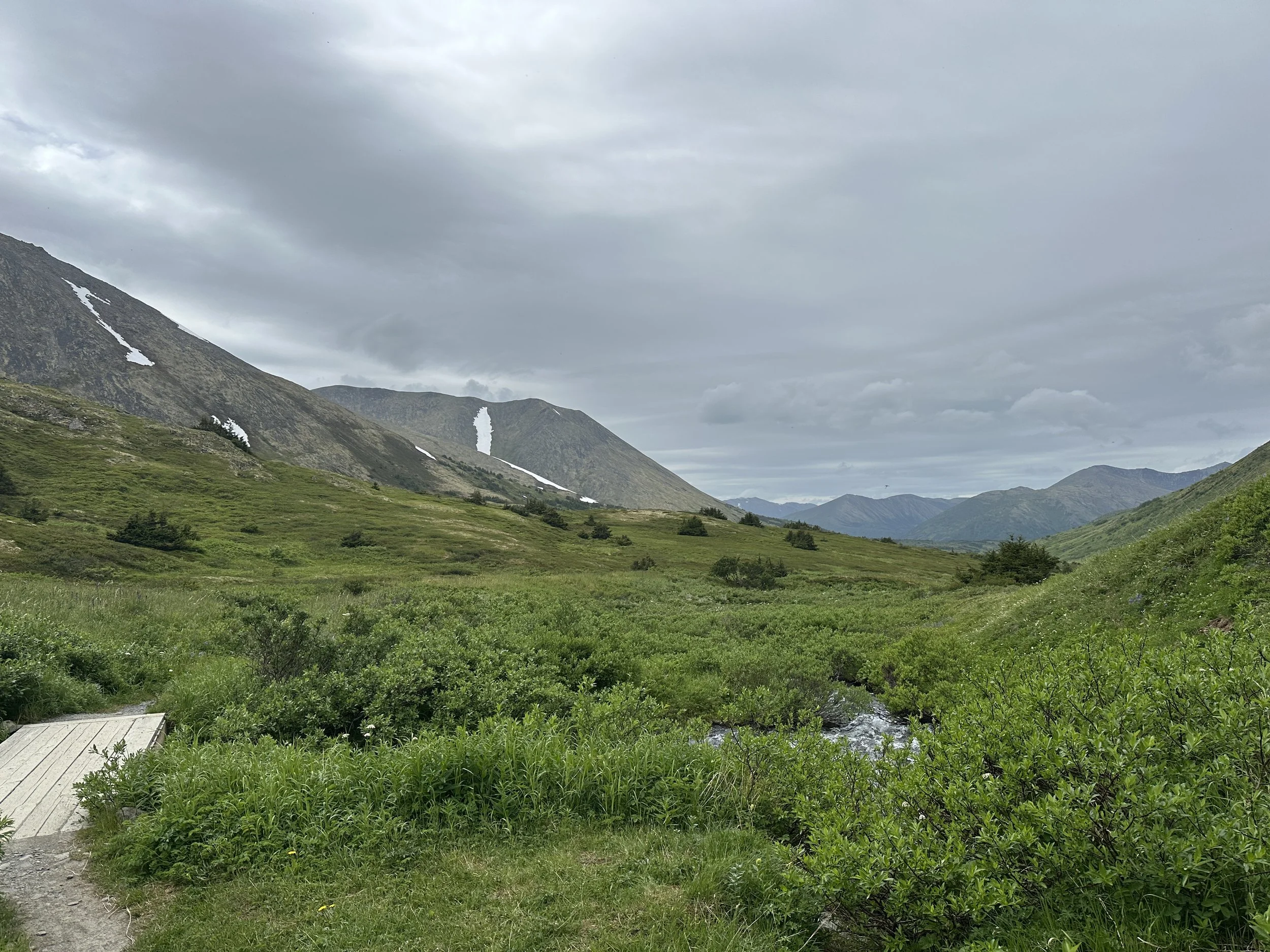
Very early on Day 2, we finally hiked out of the trees and started getting some alpine views, just shortly past the East Creek Cabin. The climb continued to be gradual, so much so that we didn't even realize it when we made it to our high point on the pass. You spend several miles walking through Resurrection Pass with tons of wildflowers, meandering streams, and 360-degree views of gorgeous mountains. There were tons of marmots screaming in the distance, but we never saw any larger wildlife. 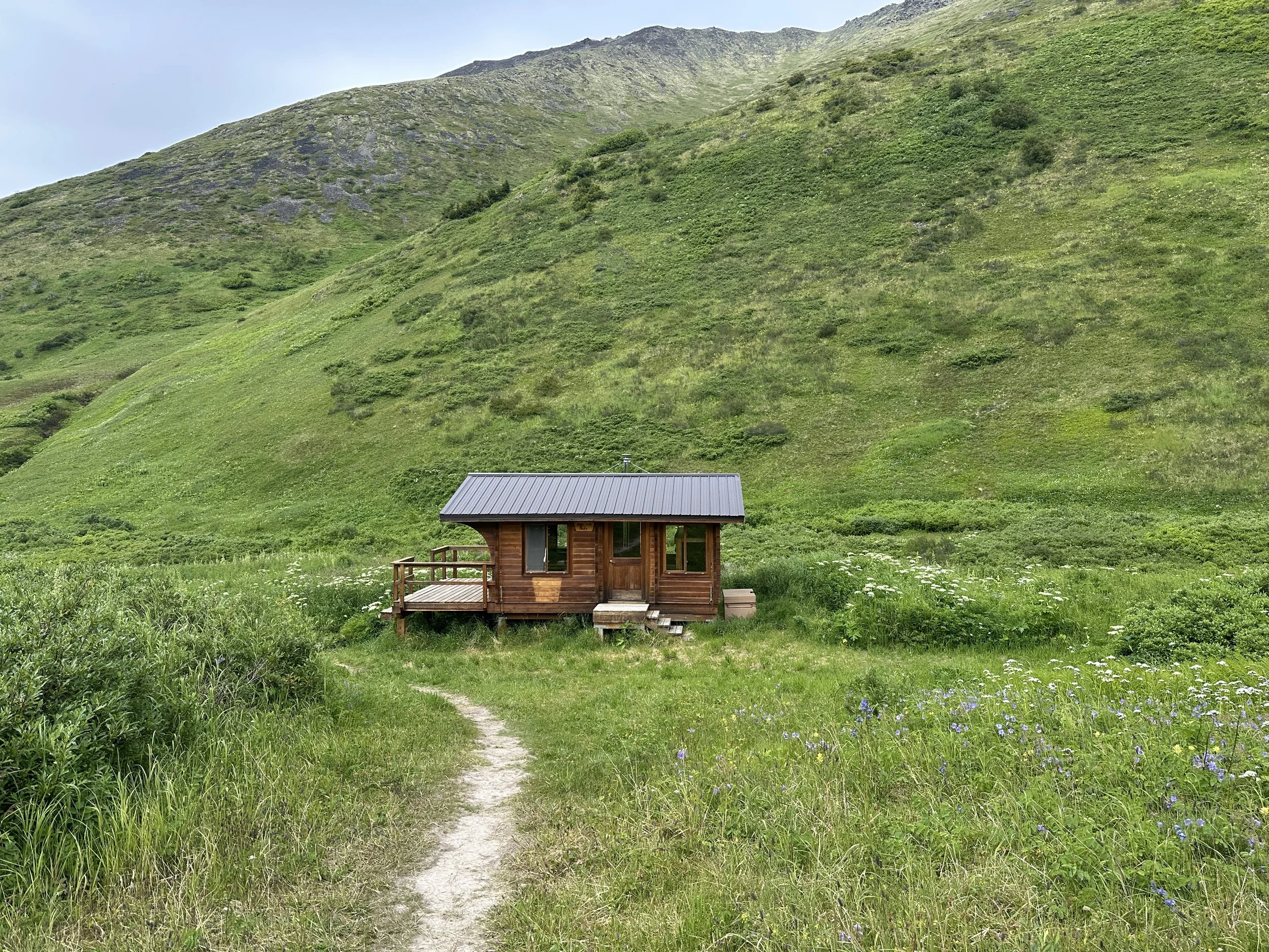
We took a lunch break at Devil's Pass Cabin, which is arguably the most beautifully located cabin on the trail. Afterwards, we started our slightly less gradual descent down from the pass, looking at Juneau Lake in the distance. After a couple switchbacks, there's a fork in the trail with signs for Swan Lake Cabin. We took the side trail (which eventually loops back to the main Resurrection Pass trail) and arrived at the cabin in about 1/2 mile, but we had trouble finding the campsite. It appears that the campsite closest to the cabin has been overgrown, so we weren't able to stay there. We backtracked to the other side of the Chickaloon River and continued walking along the Swan Lake Cabin Access Trail, and we eventually arrived at Campsite #11 that overlooks the lake after about 1/4 mile. This is where we spent our second night, after a 14-mile day of hiking. There was another pit toilet and a bear locker, along with 3 small tent spots, although they were a little lumpy. 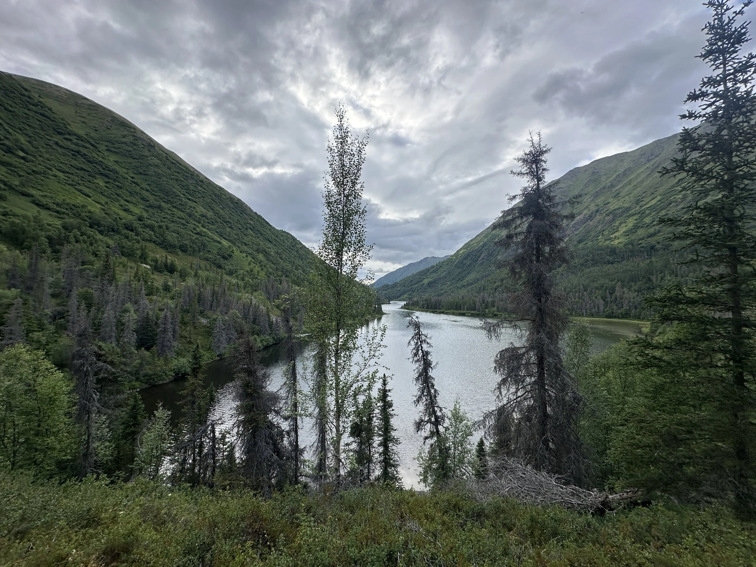
With 'only' 13 miles left, we figured we would hike to the car a day early. The trail continues to descend towards Juneau Lake, which is another crown jewel of this trip. The trail follows along the shore of the lake for a couple miles and passes the beautiful Juneau Lake Cabin, which comes with a couple of canoes for cabin users to take for a spin (as do all of the other cabins on lakes on this trail). We kept walking and opted to skip the side trail to Trout Lake. This side of the trail goes through a burn scar, allowing for more mountain views than the north side.
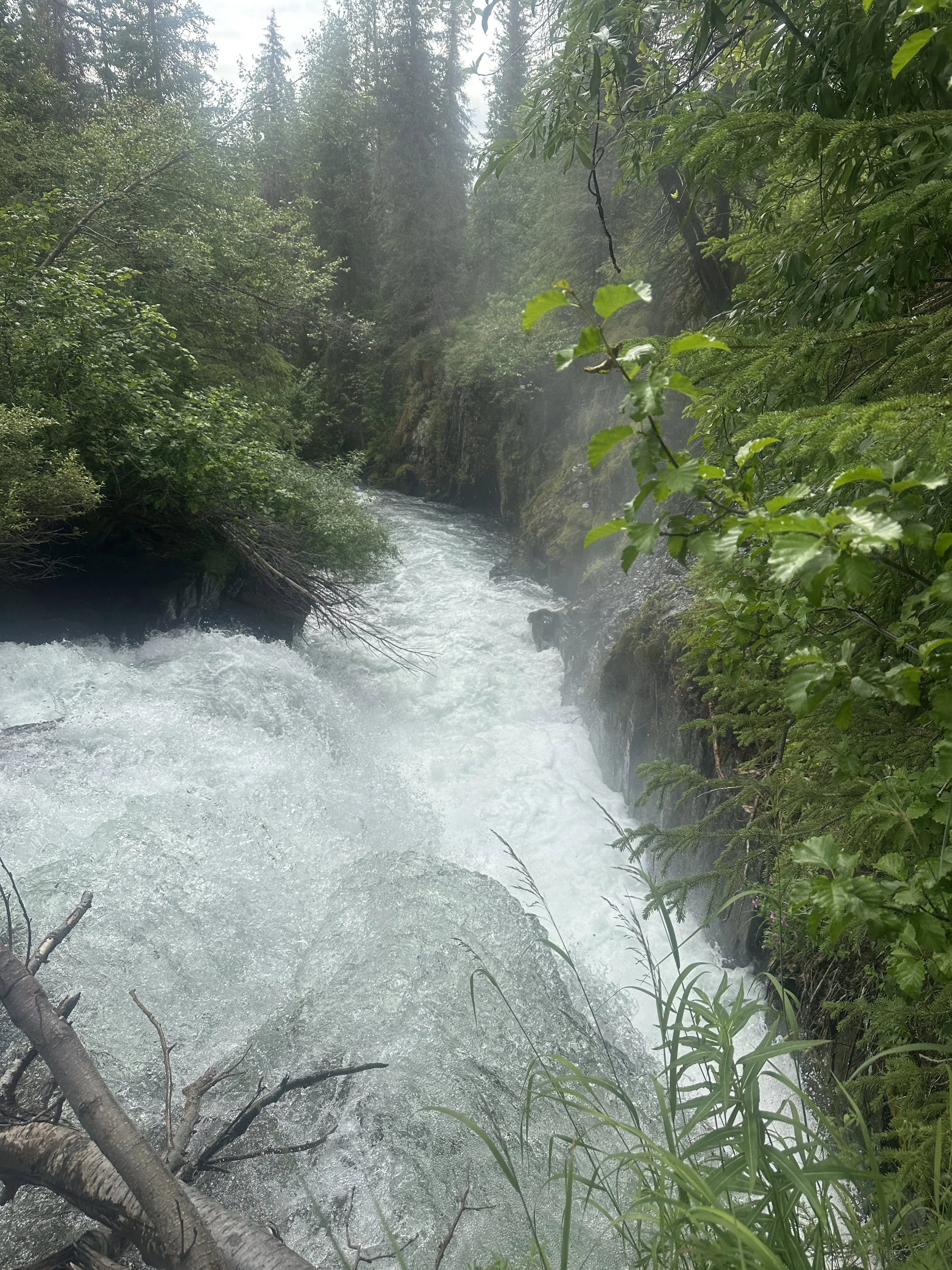
Right before Juneau Creek Falls, the trail dips back into thick forest and you lose some views. There was a short side trail that allows you to climb down to overlook the falls, but please use caution. Shortly after the falls, the trail is rerouted for Sterling Highway construction (as of summer 2025), so you have to walk around cones and heavy machinery for about 3/4 mile. The trail ducks back into the trees and descends for 3 more miles until you finally arrive at the trailhead in Cooper Landing.