Kachemak Bay and Grewingk Glacier

Quick Facts:
Drive time: 4 hours from Anchorage
Mileage: 4-28 miles
Elevation gain: Varies
Activities: Backpacking
Estimated time: 1-3 days
There are endless options when it comes to Kachemak Bay. There’s a good-sized trail network and several different water taxi landings to choose from. I’ll cover the backpacking trip that we did in July 2025, but you can find additional information and maps here.
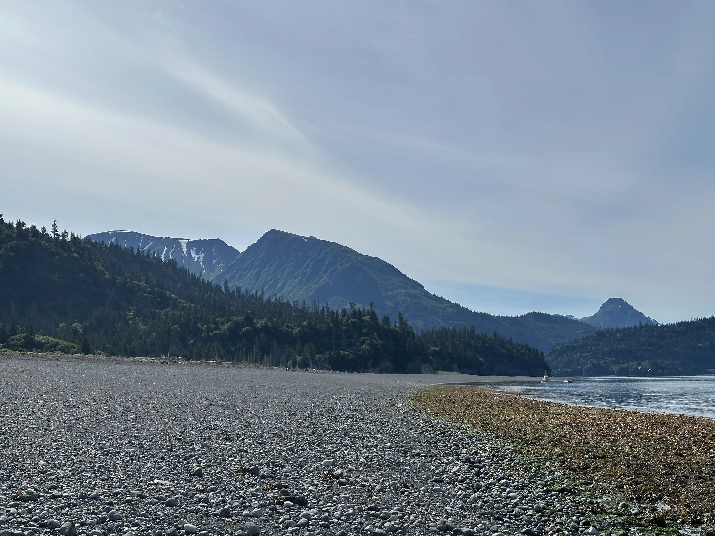
Starting in Homer, Alaska, we took a water taxi from Homer Spit over to Glacier Spit which took about 20 minutes. We used 49North Water Taxi as they allowed dogs and had last-minute availability, and they were great! We also booked our return trip with them, and they were very punctual picking us up from the park. The roundtrip cost was about $100/person.
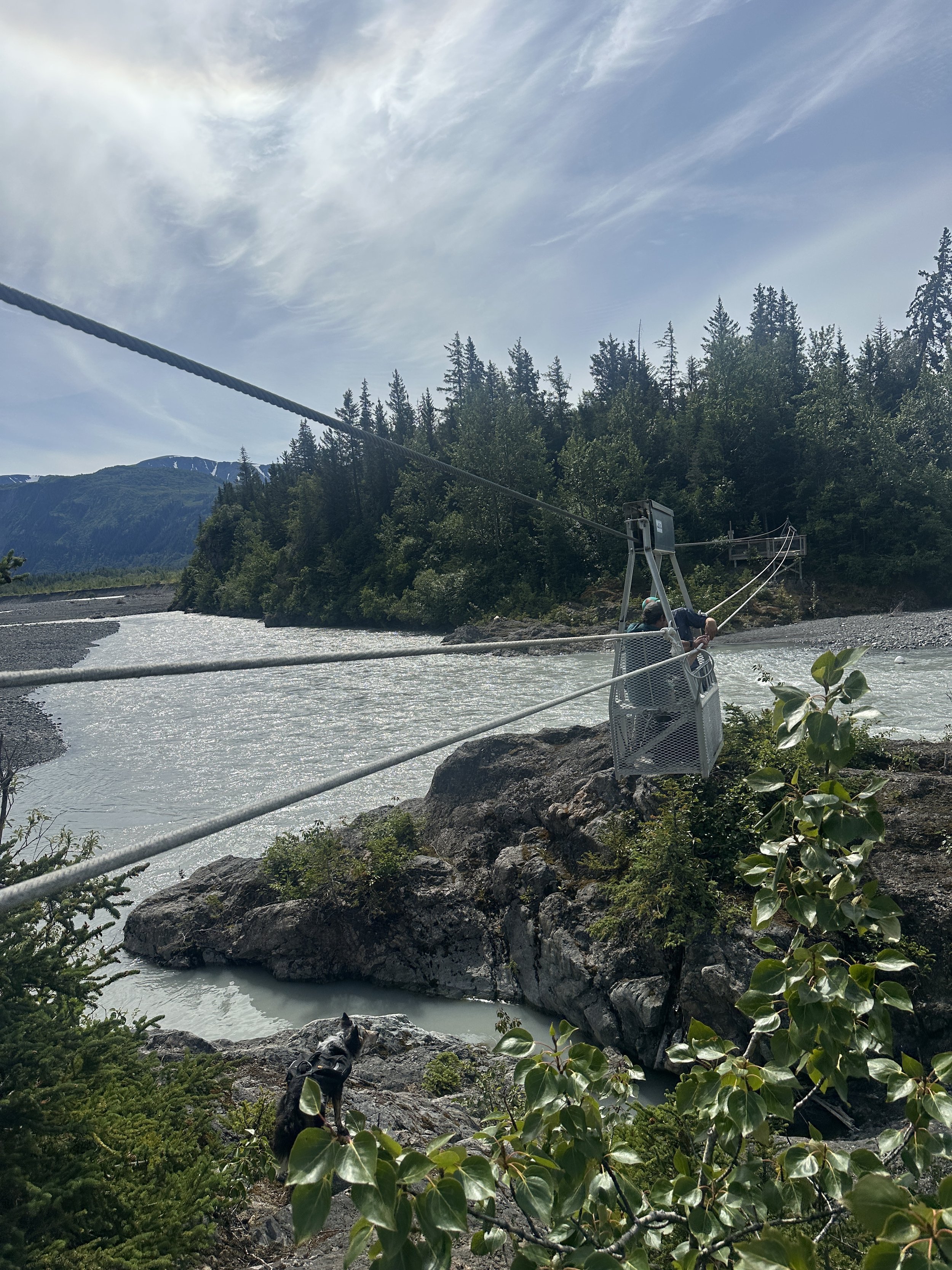
After being dropped off at Glacier Spit, we walked along the beach and did some tidepooling on the way to the Glacier Spit Trailhead. From there, we hiked 2 miles along a flat and very maintained trail to the hand tram where we lugged ourselves across Grewingk Creek. This ended up being more tiring than expected, so make sure to reset the hand tram after you’re done to make it easier for future groups. We also chose to drop our large backpacks before the hand tram for the out and back hike to the glacier overlook.
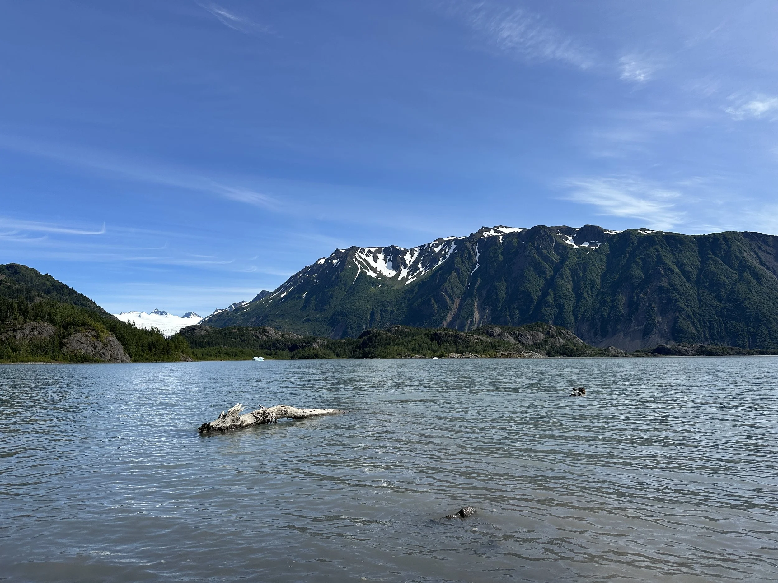
Once you get to the other side of the creek, the trail clearly becomes less traveled. There were several overgrown parts with lots of Devil’s Club, so we were very thankful to be wearing long sleeves and pants. There was also tons of bear signs on this side of the creek so continue to make noise and always carry bear spray. We never saw a bear, however. Throughout the trail, you’re greeted with an occasional overlook with a view of Grewingk Lake and Glacier. You do have to hike up and over Foehn Ridge, and after the descent, you arrive at a nice beach on the lake where we watched thousands of seagulls nest. The middle section of the trail had lots of cairns making it easy to follow.
From the lake access, it’s another mile or so to the glacier overlook. The trail became almost nonexistent towards the end, and we scrambled and bushwhacked up some rocks to get to the best view which was well worth it. Afterwards, the trail just returns the way you came back to the hand tram and to the original fork where you can turn off for camping at the glacier lake. Andy was feeling stubborn and didn’t want to bushwhack back up and over the ridge, so we continued to walk along the lake and creek from the lake access. There was some occasional bushwhacking and route-finding, but it was relatively straightforward and saved us time in the end. However, once the hand tram was in view and we thought we made it back, there was a deep, stagnant channel that we had to swim across at the very end, so if it’s a cold day, I would definitely recommend sticking to the trail.

The trail from the hand tram to the lake was a flat 3 miles. We set up our tents against the treeline on the shore of the lake and stashed our food in the bear lockers. This is where we stayed for 2 nights, enjoying the sounds of icebergs rolling in the lake and the convenience of the pit toilet nearby. There is a risk of landslides or glacier calving causing flooding on this beach, so it’s best to set up your tents on elevated surfaces. We had the beach to ourselves at night, but it got really busy during the day with all of the hiking tours that come through.

On Day 2, we were able to leave most of our things at camp and day hike up Alpine Ridge. From camp, we hiked about 4 miles and gained close to 3,000 feet through the forest. This trail was in much better shape than the glacier trail but climbed steeply through the forest with tons of blueberries and salmon berries that kept us well-fed on the way up. There were some fixed lines to help pull yourself up the muddy slopes. The trail provided beautiful views of Halibut Cove, Kachemak Bay, and the Homer Spit. We were even able to see a large raft of otters from one of the viewpoints. Once you climb above tree line, you can hike along the beautifully green, wide ridgeline covered in wildflowers, and you’ll start seeing views of Grewingk Lake and Glacier to your left. The trail ends after about 4 miles, but if you have the time and energy, you can keep walking and exploring for however long you want. We also found one large melt pond that we were able to filter and refill our water bottles with.

The last day consisted of a quick 2-mile, mostly downhill hike to the Saddle Trailhead. There’s a rocky beach area that could be explored if you are waiting for your water taxi, but ours was already waiting for us by the time we got there.
This is a great ‘choose your own adventure’ trip if you’re ever in the Homer area. It seemed that most people do day trips from Glacier Spit trailhead to the Saddle trailhead with a quick stop at Grewingk Lake, which totals about 4 miles. That’s a great option if that’s all you have time for, but I highly recommend at least spending one night in this breathtaking place.